5 Days Peakbagging the Sierra: Sawmill to Taboose Pass
SAWMILL TO TABOOSE
When both schedule and desire align, there are few pleasures in life—save perhaps the comforts of literature or a perfectly in-season orange—that can compare with an extended peak-bagging trip in the Sierra. To romp about the backcountry with joyous impunity, blazing vague cross-country routes by moonlight, delirious with fatigue while stumbling vaguely toward the silhouette of one mountain or another—it is as close to pure adventure as you can come.
The Sawmill-to-Taboose (“Sawboose,” shall we say) route wastes not a moment on banality as it meanders across two classic passes and a memorable stretch of the John Muir Trail. Nor is there a shortage of breathtaking summits. As meals go, it is a prix fixe offering of the highest standard, several million years in the baking.
Needless to say, arranging such a grand indulgence requires no small effort. The Sawboose itinerary entails a car shuttle, with one vehicle parked at the Taboose Pass Trailhead prior to the trip. And the road to the Taboose Pass Trailhead is a rough one: while occasionally tackled by two-wheel-drive vehicles, it as often leaves them intact as tatters.
SAWMILL PASS TRAIL
Depending on the season, the Sawmill Pass Trail is often best begun in darkness. The trailhead rests at an uncommonly low 4,600 ft, which is especially shocking when you consider the entire Owens Valley sits at a mere 3,900 ft, making a departure from the trailhead much like parking on the shoulder of Highway 395 and setting off for the high alpine. In the summer, daytime temperatures routinely exceed 100º, with nighttime lows in the mid-80’s, making a midday start-time the equivalent of several hours in the sauna. Only while trudging uphill. And with a fully-laden pack. All that to say, it is not advised.
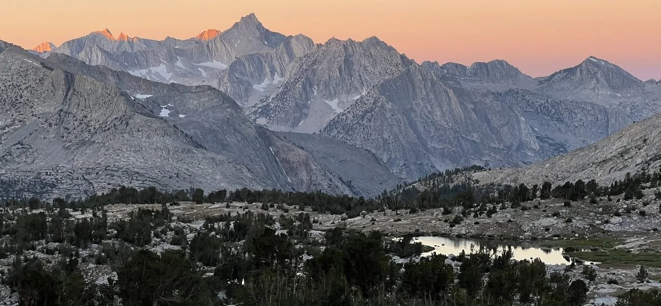
However, if you are willing to forgo sleep, the first two hours of desert hiking can be relatively pleasant. Climb from the sandy flats through rolling hills into the drainage proper, where a sharp collar of rock offers prime seating for the dawn. With some luck, weather and timing will conspire to make this a sunset unrivaled by any other—as it was for us—the red star cresting the Inyo Mountains to pour its gold into the desert.
After absorbing the vista, as well as some breakfast, duck into a broad ravine where the path turns downright lush. Draped first with pines, then with black oak and white balsam, it twice crosses the thin twist of Sawmill Creek before coming on a sudden burst of pumice. From the sagebrush flats to carpet of Sawmill Meadow, there is truly something here for everyone… provided you have no objection to climbing 6,000 ft. in the course of a single morning, of course.
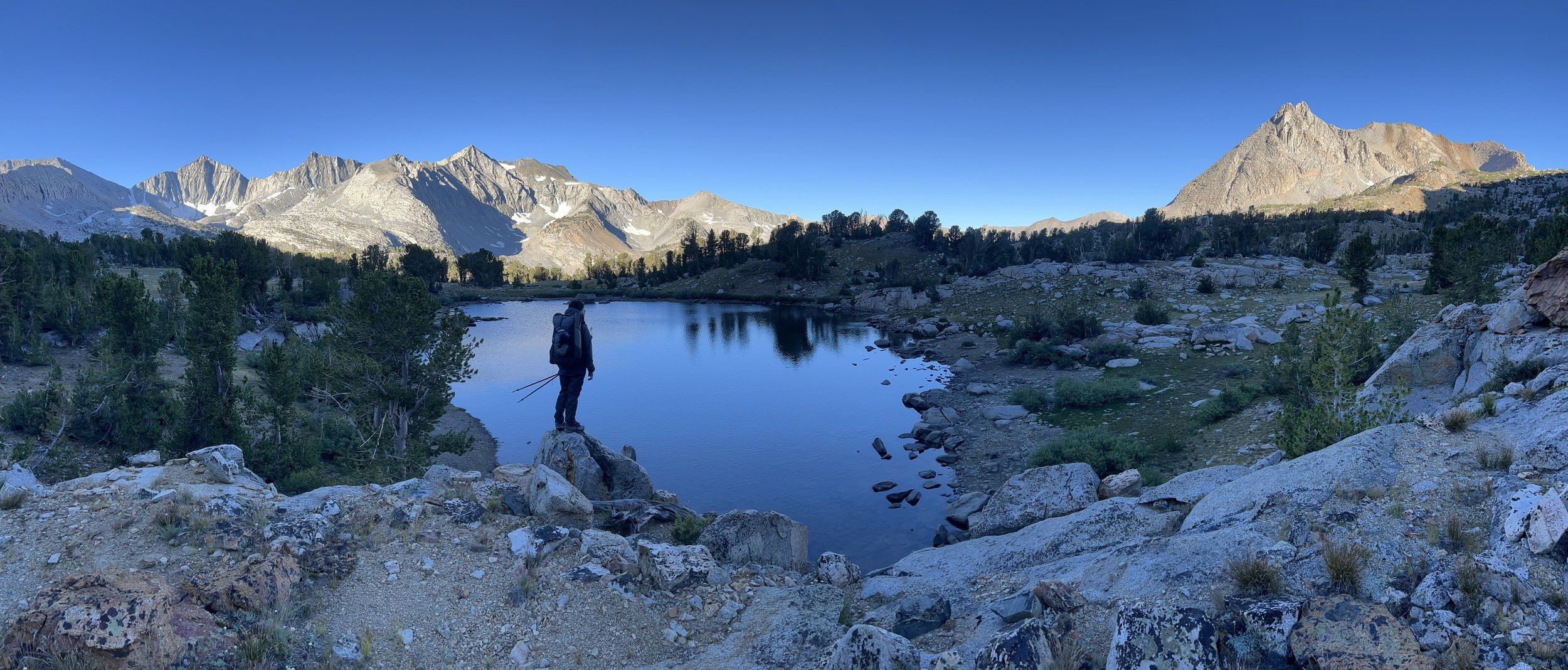
After wending between lean stands of juniper, the trail culminates in the shattered talus typical of all Sierra passes. A sharp right turn reveals Sawmill Pass itself, which appears quite suddenly. A pair of signs stand sentinel over a sweep of rocky grassland, and the hiker begins their gentle descent into the Woods Lake Basin, as picturesque a region as one can hope to find on this small planet.
COLOSSEUM MOUNTAIN
This gentle climb is not without its drama and serves as perfect introduction for the peaks to come. On descending from Sawmill Pass, break from the trail as you near the first lake and cut north across rolling country until finding a secure perch on which to stash your camping gear. Proceed northward with renewed vigor and greatly lightened packs along the folded basin toward the unseen Colosseum Col.
Here you may choose between cordial ribs of layered rock and a grassy swale to hiker’s left which can be followed as it lies, tracing its water-scar up to the ridgeline.
Once atop Colosseum Col, enjoy views of Mount Wynne and Mount Pinchot, the broken ridgeline of Mount Perkins, and distantly, the long bowl of talus that encloses Taboose Pass.
The climb from here is relatively straightforward. Pick your way up the mountain’s ridge until its grade eases and you are forced onto the tremendous southeastern slope. While the climbing is basic, the scope is daunting. This is certainly the case for the broad summit plateau, which seems another world entire. A vast and rocky plain that dangles high above the Woods Lake Basin, large enough to house a village, lifting gently toward its true summit.
PINCHOT / WYNNE
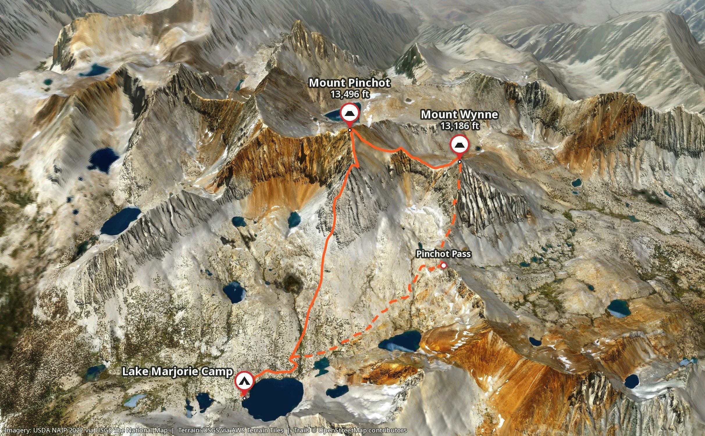
Neighboring pyramids that vie not only for attention but inordinate amounts of sweat, given their seemingly straightforward approaches. If you are in a state of delirium on one, you most certainly will be on the other. To link the two—aesthetically pleasing as it seems—is a route highly recommended to absolutely no-one. However, if traipsing about the fringes of the afterlife is your cup of tea, have a go at the traverse.
A challenge with some currency around hardened peakbaggers, the traverse has been rated variously as C3, C3+, C3++ (if such a thing exists), and C4 by trustworthy mountaineers, with a unanimous focus on poor rock quality and frequent use of the word “nasty.”
Regardless of specific ratings, it is a handful, any way you cut it. Take, for instance, the infamous catwalk which is really nothing more than a foot-wide slab of good rock. Only canting sideways at an awkward angle. And pitched downhill at a dizzying grade. And littered with rubble and suspect debris. And, oh yes, and with 600 ft of unobstructed exposure to either side. Add to this the distinct likelihood of gusting wind, and you see where the ratings debate arises.
Is it doable? Yes, most certainly, with prudent testing of each hand and foothold and a certain laissez-faire outlook. But is it wise? Well that, dear reader, is well beyond the scope of this write-up. I suppose in spite of my obvious aversion, I could probably be persuaded to attempt the traverse again, but under optimal conditions. By which I mean if paid a sum of several million and in possession of a stellar life-insurance policy.
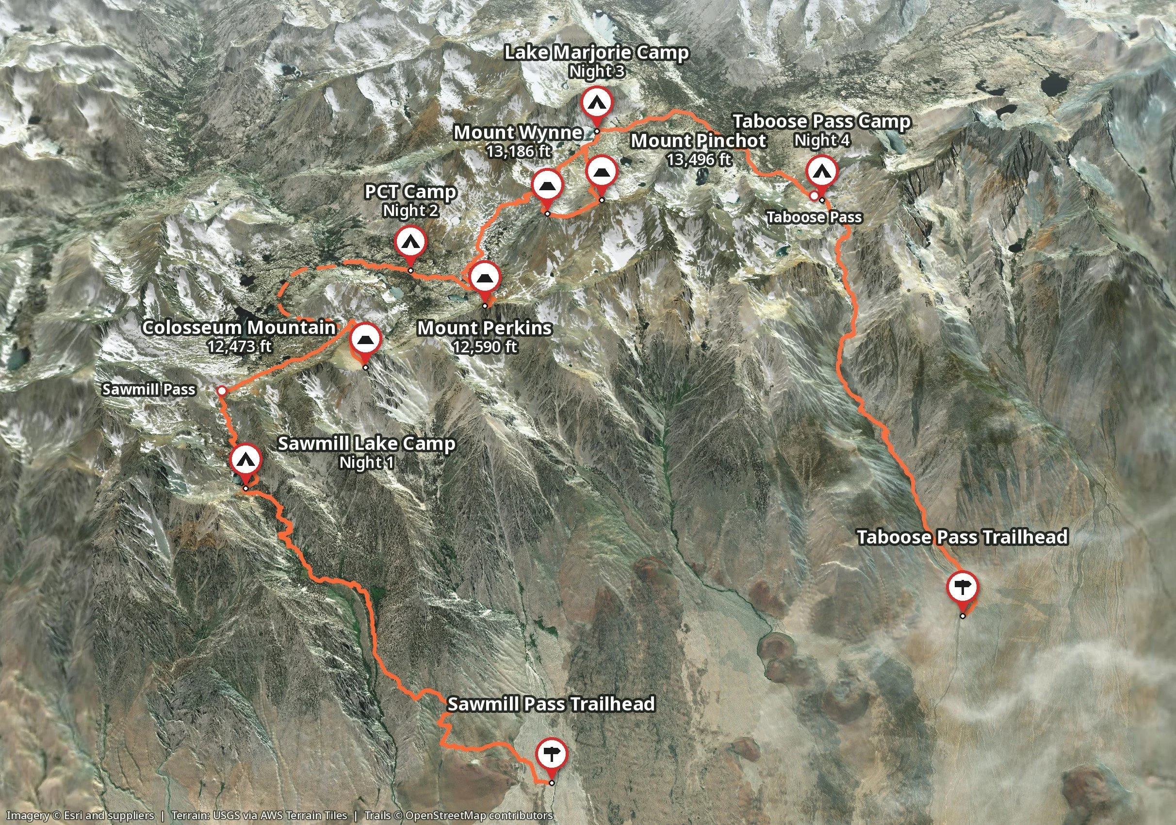
Total Distance: 39.6 miles
Elevation Gain: 14,932 ft